
By Rabir, Meteorologist
Every day, we look up and notice clouds drifting overhead—in countless shapes, sizes, and shades. Yet, these atmospheric wonders are much more than visual curiosities. As a meteorologist, I find that understanding cloud types offers a direct window into the dynamics of our weather, both present and future.
The Basics of Cloud Formation
Clouds form when warm, moist air rises and cools, causing water vapor to condense into tiny droplets or ice crystals. This process is influenced by temperature, humidity, air pressure, and even particles like dust. Depending on these factors, clouds exhibit a range of forms, each with its own implications for weather.
Key Cloud Types and Their Signals
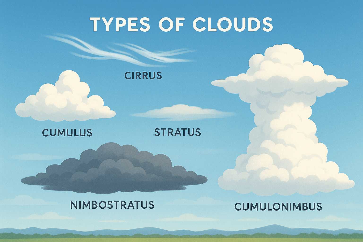
1. Cirrus Clouds: Wispy, high-altitude clouds that look like delicate feathers. They often signal fair weather but may herald an approaching change, such as a warm front or developing storm system.
2. Cumulus Clouds: Those fluffy, white cotton balls against a blue sky—cumulus clouds—typically suggest fair weather. However, when they build vertically into towering cumulus or cumulonimbus, they can quickly lead to showers or thunderstorms (see my article on "How Thunderstorms Form").
3. Stratus Clouds: These form in low, even layers, giving the sky a gray, overcast appearance. Stratus clouds are associated with light drizzle or mist, and sometimes, persistent gloomy weather.
4. Nimbostratus Clouds: Thick, dark gray clouds that blanket the sky, bringing steady, prolonged rain or snow. "Nimbus" means rain-producing.
5. Cumulonimbus Clouds: Tall, anvil-shaped giants that dominate the sky during intense weather events. These clouds are the engines behind thunderstorms, hail, and even tornadoes.
What Can Clouds Predict?
Meteorologists use cloud observation, alongside other tools, to forecast weather changes. For example, a sudden appearance of cirrostratus clouds means moisture is increasing at higher altitudes, possibly leading to precipitation within 12–24 hours. Similarly, rapidly growing cumulus clouds warn us of developing convective activity—an essential ingredient for thunderstorms.
A Window Into Atmospheric Science
Watching clouds can heighten our awareness of atmospheric processes in action. They illustrate the interplay between heat, moisture, and rising or sinking air. Next time you step outside, take a moment to observe the sky: it’s telling a meteorological story, one cloud at a time.
Whether you’re a curious observer or just planning your weekend, decoding the clouds above is both captivating and practical. After all, understanding the science behind the weather empowers us all to be a little more prepared for whatever the sky may bring.
Leave a Reply