Derecho storms, though less commonly discussed than hurricanes or tornadoes, are among the most powerful and destructive weather phenomena in North America. Stretching for hundreds of miles and packing wind speeds that can rival those of major hurricanes, derechos leave behind swaths of damage, power outages, and lasting impacts on communities.
What is a Derecho?
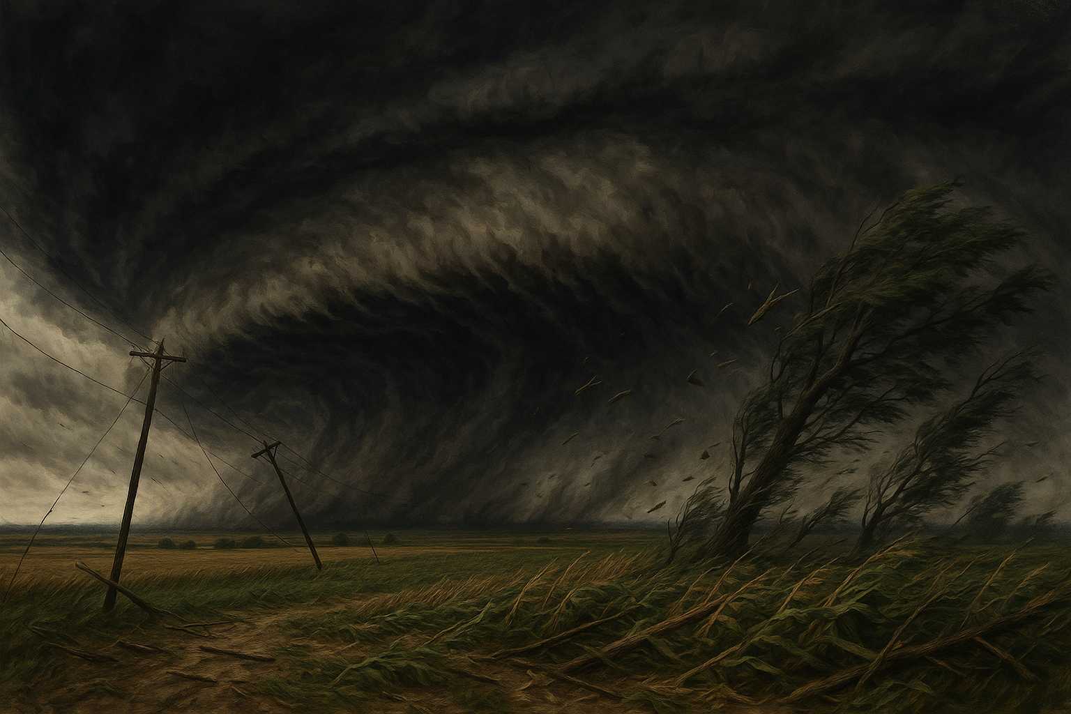
A derecho (pronounced "deh-REY-cho") is a widespread, long-lived wind storm associated with a band of rapidly moving thunderstorms. To be classified as a derecho, a storm system must produce wind damage over a path at least 240 miles long, with wind gusts exceeding 58 mph (93 km/h), and several well-separated reports of gusts over 75 mph (121 km/h).
Derechos typically occur from late spring through summer, especially in the Midwest and Great Plains of the United States. However, they can form almost anywhere given the right atmospheric conditions.
How Do Derechos Form?
The essential ingredient for derecho formation is a line of thunderstorms, commonly called a "squall line," that accelerates as it interacts with strong upper-level winds and a highly unstable atmosphere. As cooler air from the thunderstorm downdraft collides with warm, moist surface air, powerful winds are funneled downward. When these winds surge outward, they can create damage patterns similar to those from tornadoes, though the winds in a derecho are primarily straight-line rather than rotational.
Notable U.S. Derecho Events
- August 2020: Midwest Derecho — One of the most infamous recent derechos struck Iowa and neighboring states, with winds exceeding 100 mph. The storm damaged or destroyed crops across millions of acres and knocked out power to over a million people.
- June 2012: Ohio Valley/Mid-Atlantic Derecho — This long-lived event swept from the Midwest through Washington, D.C., causing fatalities, extensive power outages amid a heatwave, and millions of dollars in damage.
Human and Community Impacts
Derechos tend to catch communities off guard because their wind damage is sudden and broad in extent. Unlike tornadoes, which often have well-established warning systems, derechos may develop quickly from existing thunderstorms, leaving little time for preparation. The aftermath often involves extensive utility repairs, emergency borrowing from food banks, and recovery efforts akin to hurricane cleanup.
Elderly residents, people living in mobile homes, and communities with vulnerable infrastructure face the greatest risks. Agricultural sectors, especially when crops are nearing harvest, can suffer devastating losses.
Safety Tips for Derecho Events
As a meteorologist, I urge everyone to take wind advisories and severe thunderstorm warnings seriously, especially during the peak derecho season. Here are a few key tips:
- Move Indoors Quickly — Seek shelter in a sturdy building away from windows and glass doors.
- Secure Outdoor Objects — Bring in or anchor patio furniture, grills, or any loose items that could become dangerous projectiles.
- Stay Informed — Use weather apps or NOAA Weather Radio for up-to-date warnings.
- Avoid Roads — High winds can topple trees and powerlines rapidly, making travel extremely hazardous.
Preparation and awareness are your best tools against derechos. While these storms can be devastating, understanding their science and potential impact goes a long way in keeping you and your community safe.
Leave a Reply