As 2025 draws to a close, the United States is experiencing a dramatic weather whiplash: from record warmth in the South to blizzard and tornado conditions sweeping the Midwest and Great Lakes. The stark temperature shifts and severe storms have disrupted holiday travel for millions and serve as a stunning reminder of the volatility of our current climate.
Extreme Warmth Followed by Deep Freeze
Atlanta, for example, shattered its previous Christmas Eve high, soaring to 78°F (26°C). Dozens of other Southern and Midwestern cities also broke temperature records in the days following Christmas. Yet this springlike warmth is coming to an abrupt end. Over just 48 hours, much of the central and southern U.S. will tumble from 20 to 30 degrees above average to 10 to 15 degrees below normal—a swing made possible by a powerful cold front surging south from Canada[5], [3].

This icy plunge will bring dangerous wind chills—as cold as minus 30°F—in states like North Dakota and Minnesota, making frostbite a real threat within minutes[3]. By early Tuesday, southern cities like Atlanta are forecast to drop to lows of 25°F (−3.9°C), with the cold expected to persist through New Year’s Day[5].
Blizzard Conditions and Tornado Threats
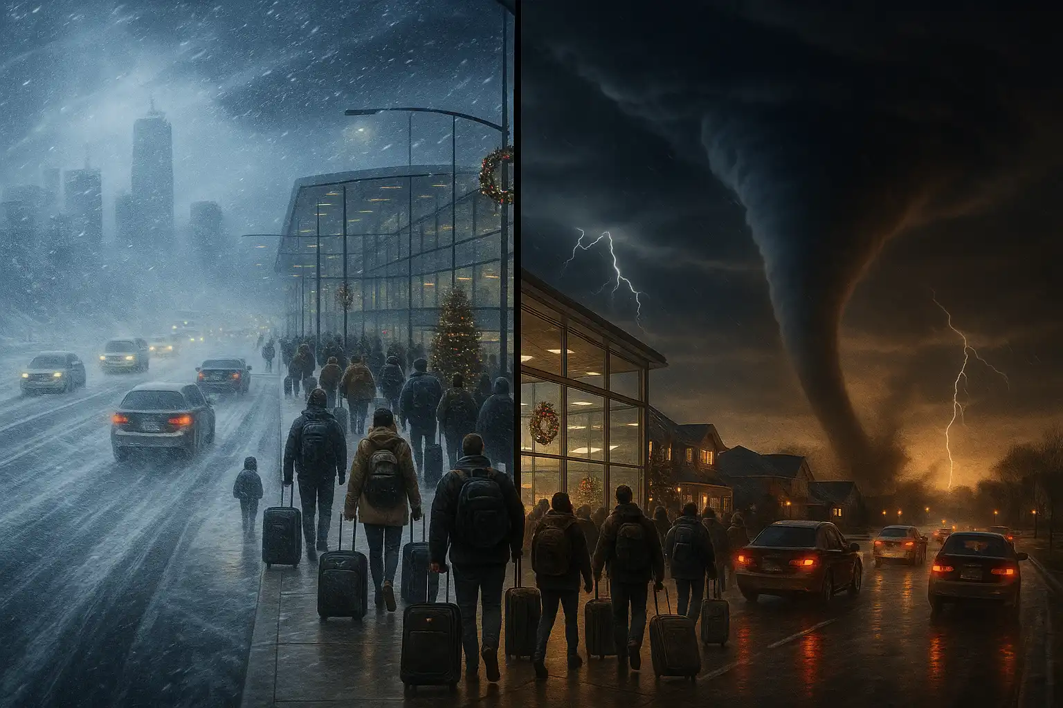
A rapidly intensifying low-pressure system is at the heart of the current chaos. Fueled by the collision of Canadian cold and lingering southern warmth, the storm is impacting the Upper Midwest, Great Lakes, and Northeast with heavy snow, blizzard warnings, icing, severe thunderstorms, and even tornado threats to parts of the Midwest and lower Ohio Valley[2], [3].
Blizzard warnings cover parts of Iowa, Minnesota, and Wisconsin, where wind gusts between 40 and 60 mph are driving heavy snow into whiteout conditions. As of Monday, over 30 million Americans were under some form of winter weather alert, and widespread travel snarls were reported across the region during one of the busiest holiday periods[3].
Further south and east, severe thunderstorms are threatening damaging wind gusts and isolated tornadoes—an unusual pairing with winter storms, but not unprecedented given the presence of warm, unstable air ahead of the cold front[2].
A Broader Climate Story
The current U.S. weather extremes are also linked to dramatic shifts in the Arctic. According to NOAA, the 2025 water year brought the highest Arctic air temperatures since records began 125 years ago. Unusually wet atmospheric rivers, which transport vast amounts of water vapor, contributed to record-high precipitation and accelerated losses of snow and sea ice in the region. The Arctic is warming more than twice as fast as the global average—a trend that influences weather patterns well beyond the polar circle[1].
Human Toll and Safety Precautions
For communities caught in the grip of these extremes, the dual threat of tornadoes and blizzards is a reminder to heed alerts and prepare for rapid changes. During blizzards, avoid unnecessary travel, keep emergency kits stocked, and ensure you have a way to receive weather warnings. In tornado-prone areas, have a safe shelter ready and stay tuned for updated forecasts.
The recent cascade of contrasting extremes—balmy records, then bitter cold, tornadoes and paralyzing snows—speaks to a climate system in flux. As we enter 2026, staying informed and prepared will be essential for weathering these unpredictable patterns.
References
- NOAA: Higher Temps and Less Ice in a Changing Arctic – The Maritime Executive
- Tornado Threat Looms Over Midwest as Blizzard Conditions Blanket Region – Newsweek
- Blizzard conditions and tornadoes disrupt travel as winter brings frigid reality check back to the US – CNN
- A winter storm threatens to bring blizzards and ice to parts of the U.S., hampering holiday travel – Bozeman Daily Chronicle
Leave a Reply