

The middle of April 2026 is rewriting the rules of weather across the eastern United States. Unprecedented heat is gripping the region, with temperatures soaring toward record territory from Georgia all the way to New York City—a scenario typically reserved for mid-summer, not the heart of spring. At the same time, a relentless parade of severe storms has left a trail of tornadoes, flooding, and hail across the Midwest and Great Lakes, testing the resilience of affected communities.
Borderline Unprecedented: The Heatwave that Won’t Quit
A persistent and unusual weather pattern has acted like a furnace, sending sweltering air over much of the East this week. In cities like New York, Washington D.C., and Philadelphia, daily high-temperature records were not just threatened but in many cases shattered, with some locations flirting with or surpassing 90°F (32°C)—an event rarely seen in April. The National Weather Service and other meteorologists have noted that it’s not only the intensity of this heatwave but its duration that makes it extraordinary. On Friday, widespread lower to mid-90s were forecast across the Carolinas, with the possibility of additional daily and even monthly records falling[1].
The heatwave comes on the heels of record-breaking drought conditions in much of the U.S. over recent months. More than 61% of the Lower 48 states now face moderate to exceptional drought, threatening wildfire seasons, water supplies, and raising concerns about agriculture and food prices. Meteorologists stress that both natural variability and climate change amplify these extremes, making heatwaves like this one more likely and impactful[2].
Tornadoes, Floods, and Lightning: The Stormy Side of April
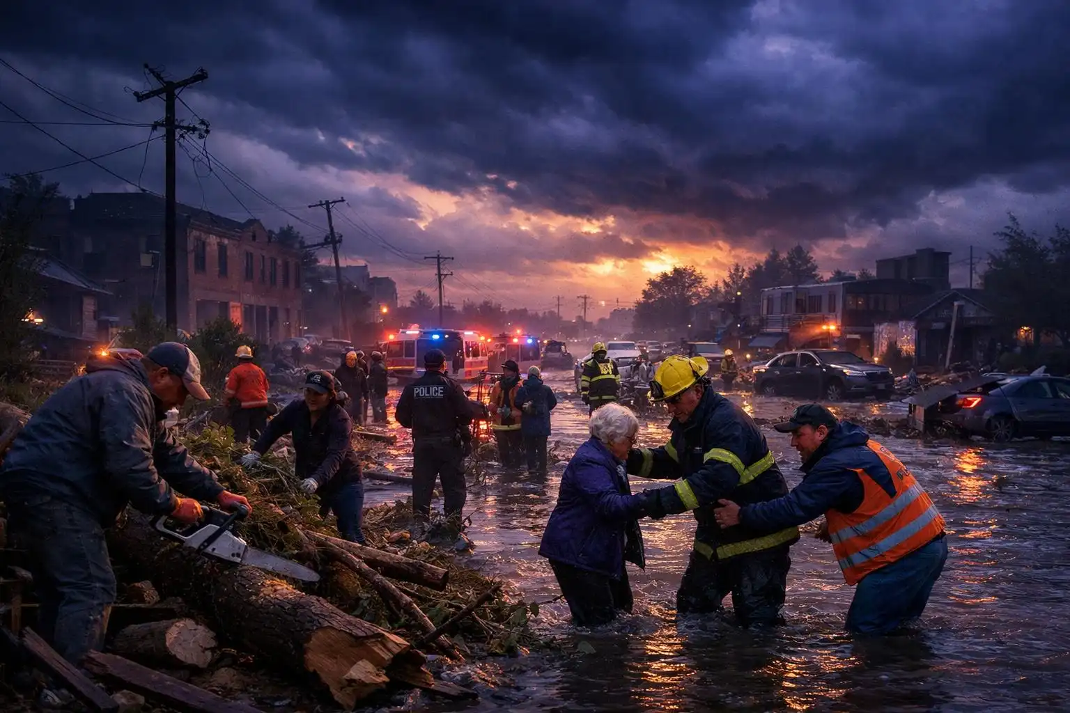
While the East bakes, the Midwest and Upper Plains have been battered by nearly continuous rounds of severe weather. From Monday through Wednesday alone, over 1,100 reports of large hail, damaging winds, and tornadoes poured into the National Weather Service. Teams are still out surveying the paths of destruction. Southern and central Wisconsin were especially hard hit, including a powerful EF3 tornado near Union City with estimated peak winds of 140 mph—the strongest April tornado in Wisconsin in 15 years. Further east, record rainfall totals have flooded parts of Michigan and the Great Lakes[3][4].
The severe weather has been relentless, with a string of tornadoes nearly every day and a spectacular amount of lightning. Tragically, storms claimed at least one life in Wisconsin due to a lightning strike, highlighting the very real dangers these patterns pose, especially with temperature and humidity levels more characteristic of June than April[3].
Looking Ahead: A Brief Respite, Then More Storms
Relief from the record heat appears on the horizon as a strong cold front is forecast to sweep through the Eastern Seaboard by late weekend, bringing cooler and more seasonable temperatures for the start of next week[1]. The severe weather threat in the Midwest and Great Lakes area is expected to diminish for a few days, giving hard-hit communities a chance to recover.
However, meteorologists caution that this break will be short-lived. As the cold front advances and a new batch of unstable air arrives, another surge of severe weather is expected to ignite from the southern Plains to the Lower Mississippi Valley by late in the week. Areas from Oklahoma and Kansas to Texas, Missouri, and Arkansas should all be on alert for heavy rainfall, large hail, and even more tornadoes—many of the same populations still cleaning up from last week’s storms[5].
Community Impact and Safety
These extraordinary weather extremes are more than data points—they disrupt lives and livelihoods. Power outages, destroyed homes, flooded streets, and tragically, loss of life serve as solemn reminders of nature’s power. Communities in the most affected areas are banding together to clear debris and repair damage, but the persistent threat makes full recovery an ongoing challenge.
Safety Tips:
- Remain weather aware; watch for severe weather watches and warnings on trusted sources like NOAA Weather Radio or smartphone alerts.
- If a tornado warning is issued, seek shelter immediately in a basement or interior room on the lowest floor, away from windows.
- During heatwaves, avoid strenuous outdoor activity, stay hydrated, and check on vulnerable neighbors and family members, especially children and the elderly.
- When lightning is in the area, go indoors right away. Remember: “When thunder roars, go indoors.”
As April 2026 sets new records and pushes communities to their limits, it’s a stark reminder of the need for preparedness and resilience in an era of intensifying weather extremes.
References
- Nature puts heat on blast as scorching temperatures in eastern US could smash records – AP News
- Record US drought sparks worries about fires, water supply and food prices – AP News
- Severe storms continue to produce heavy rain, lightning and flooding across parts of US – AP News
- Severe Weather, Including Threat Of Strong Tornadoes And Flooding Rain, Forecast Friday In Plains, Midwest – The Weather Channel
- The Severe Threat Takes A Few Days Off Before Ramping Up Again Across Plains, Southern States Late This Week – The Weather Channel
Leave a Reply to Fact-Check (via Claude claude-sonnet-4-5-20250929) Cancel reply